
What Can You Learn From Vintage Maps
[ more about maps ]
This is the age of digitization, and you get accurate information about the place through Google Maps, GPS, and other high-end technology. But if you are an enthusiast, a student, or a researcher, you can trust the historical maps.
Anyone of this generation can question the importance or even relevance of historical maps. The most updated digital maps can not be replaced. From common people to travelers - everyone uses them to know about the history of a place and the flow of civilization.
Believe us, historical or vintage maps still hold importance even today. This article discusses what you can learn from vintage maps.
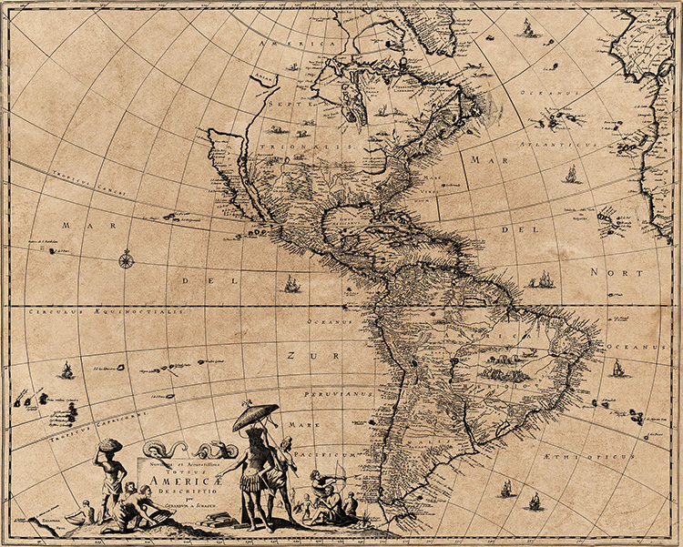 vintage map of the Americas
What Are Vintage Maps?
Vintage maps provide you with a graphic picture of the bygone days. With these maps, you can get near-accurate data on the topographical pattern of the place during the time.
Furthermore, you can get a picture of the settlement patterns of the site. Apart from them, you can also understand how the nations or places shared boundaries between two countries back in the olden times.
These maps give a fascinating description of the past, and you can easily compare it with the present and updated maps to understand the difference.
What Can You Learn From Vintage Maps?
History is an essential document that takes an individual or a nation forward. The human being is inquisitive naturally. Their unending thirst to know the unknown propelled the discovery of new lands and opportunities. Be it Marco Polo or Columbus, they used maps to reach new destinations.
The vintage maps are important to the enthusiasts, the students, and the researcher who are trying to go deep to understand the history and geography of the place. This is why, even today, they have a lot to offer. Historical maps are viewed as one of the most authentic documents.
1. Preserving The Past
If you want to know your city, London, Paris, or New York closely, you can get accurate information from the lastest most updated maps. But if you want to know about the place two to three centuries ago, you can find that information using vintage maps. These vintage maps show the topographical features of the maps and help you recede back to the future.
You can get these maps from experts preparing these maps. They are professionals, and they have databases through which you can get old maps. Fascinating, isn't it? To know more, you can visit this website.
2. Antique Collections Are Always Inspiring
You might have heard about the gentleman called David Runsay. He has a collection of around 150,000 maps. He is undoubtedly one of the finest collectors of such maps. He continued his work of finding old maps and digitizing them.
It exemplifies the human urge to preserve the ancient past for the future generation. These maps will undoubtedly be a treasure trove for enthusiasts. Hence you can use these maps to preserve the past, present, and future.
3. Understanding The Flow Of Civilization
As mentioned, vintage maps are the most authentic resources for understanding and writing history. This is why the researchers get help from these maps. For example, if you try to understand the reasons behind the development of a civilization, you need to understand the geography but also the parallel history of it.
Be it the Maya Civilization in Mexico or the Indus Valley civilization of India; you can understand a great deal with the help of history. Not only that, if you wish to write about the history of a budding city, you can understand it through vintage maps.
With the help of the topography and the housing patterns, you can get an idea of the lifestyle of the people during the bygone days. The landscape or the terrain can speak a lot about the evolution of civilization during that time. So these are like treasure troves to historians or researchers.
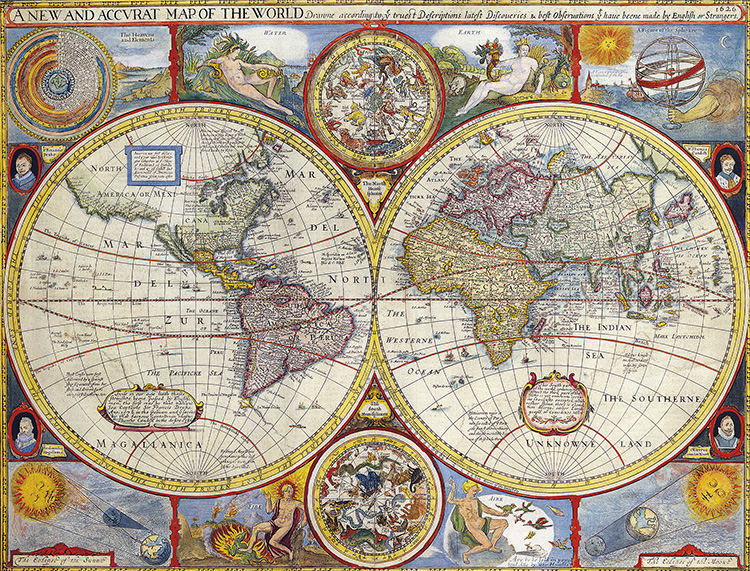 vintage map
4. The Vintage Maps Improve Your Geography
You might get the most accurate information on a place through the most updated maps available online. They are highly informative, but they need to be more interesting and inspiring.
The vintage maps, on the other hand, can help a student develop an interest in geography. A 2013 study revealed the fact that individuals who relied on historical maps developed a sense of history much better.
These vintage maps have the efficacy of developing brain and eye coordination. Therefore the students take the help of books to strengthen their knowledge of geography.
5. Vintage Maps Are Great Storytellers
One of the great things one must learn from vintage maps is the art of graphical presentation of the bygone day. These maps are like the canvas showing a documentary about the place in retrospect.
This is the reason you will find that the textbooks, especially the history books, extensively use vintage maps. The students might not be interested to read the dry old lines of history, but if you provide the images, they are fascinating stories.
These old maps put things as it is and thus help weave a story in their minds. Imaginations and assumptions are part and parcel of history books.
6. You Can Know About The Spread Of Religion And People
Every religion has its own ways of growth and expansion. Be it Islam or Christianity, or other, they took birth in one place and slowly moved with people who took the movement of spreading the messengers of God. But how could you visualize it?
You can do it with the help of vintage maps. These historical maps serve as valid research tools to understand the spread of different ways of life and their evolution. This can stop you from avoiding false propaganda and taking refuge in rationalization.
Conclusion
The ultimate objective of the vintage map is to understand the past. The present civilizations are nothing but superimposed developments on the pedestal of the past.
Modern maps can give latitudinal and longitudinal accuracy but not historical flow. If you really want to know the story of evolution, you can learn it from the Vintage maps.
Do you have feedback, a comment or correction? Let us know